Re-establishing Orientation
Today was a beautifully sunny Autumn morning with almost no wind and a QNH of 1037hPa.
The aerodrome was busy with aircraft so we had to taxi down Alpha then do a quick line up and roll on RWY34@NZPP for a straight out take off, followed by a climbing turn towards Reikiorangi then a hop over to Otaki forks.
On arrival at Reikiorangi, my FI ask me where the wind was coming from and to what side of the valley I should fly. As I saw smoke drifting south-east I set the aircraft on the southern side and selected a nice ridgeline to practice my crossing procedures from last time.
Once over the saddle we settled down into the valleys and commenced travelling up some nice tributaries.
After a few 180deg turns my FI asked me where we were on the map and where we should go to get out of the mountains.
Some basic procedures to re-orientate yourself is as follows:
- Where is the sun?
- Is the ground rising or falling?
- What direction is water flowing?
- Can you identify the high points?
- Creeks flow to streams; streams flow to rivers; rivers flow to the sea.
Using these cues, I managed to find out where we were on the map and a way to travel out of the mountains and back to Otaki
rather tricky when you have to fly an aeroplane in close country at the same time.
Once we were close to the main valley entrance my FI demonstrated a precautionary landing, with mew deciding where we were going to land and if we had any major obstacles in the way.
I chose a site only to see a better one about 15secs later, that was inline with the wind and in a place where we could use the adjacent valley to descend for a short field landing. My FI said my thought processes were good and decisions made were sound. Also that I was not afraid to review my decisions and choose another site. Not bad!
My FI demonstrated the precautionary landing emphasising the fact that we needed to navigate the valley as well as fly a pattern to land safely. Lots of things happening all at once and a great test of staying focussed and flying the aircraft.
More details can be obtained at https://www.aviation.govt.nz/assets/publications/gaps/caa-gap-mountain-flying-may-2021-web.pdf
Mountain Flying Training Standards Guide https://www.aviation.govt.nz/assets/publications/flight-test-standards-guides/mountain-flying-training-standards-guide.pdf
Once again the time flashed by and before I knew it, it was time to fly out of the valley and back into the wide training area, descend to 1000ft, and head back down the coast to NZPP.
The approach to 34 was one of my better ones: right on the numbers!. However I drifted slightly in the crosswind and landed just to the left of the centreline. Drat, and double drat! A tiny bit more rudder and i would have buttered the landing!
A nice taxi back to the Aero club via A3 exit then shutdown.
Another fun training flight. Im so lucky doing this!
Happy days!
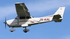
Aircraft: ZK-KAL (Cessna 172SP Skyhawk)
Total Time: 1.2
Landings: 1
Go-arounds: 0
Visual Approaches: 1
Terrain Awareness: 0.9
Until next time….
For more Blogs and Digital Photos go to https://walshephotography.com
Check out Kapiti Aero Club at https://www.kapitiaeroclub.co.nz
Blog – Terrain Awareness (4) 30/04/2022